
Lake Kabetogama fishing offers anglers excellent opportunities for walleye, sauger, smallmouth bass, northern pike, perch, and crappie. This guide covers where to fish on Lake Kabetogama, what species to target, and the tactics that work throughout the season.
Lake Kabetogama Fishing Guide
Best Spots for Lake Kabetogama Fishing
The best Lake Kabetogama fishing spots depend on season, wind, water temperature, light conditions, and the species you want to target. Productive areas often include rocky points, mid-lake reefs, shoreline breaks, narrows, weed edges, shallow spring bays, and deeper midsummer structure.
One of the strongest recurring lessons from local guide conversations is that Kabetogama rarely fishes as a one-pattern lake. At different times of year, fish may hold shallow near spawning zones, slide to weedlines, or set up deeper on reefs and breaks. On some late-summer and fall patterns, anglers may find fish in both shallow and deep water on the same day.
Use the mapped bite marks and fishing locations below to narrow your search by species, depth, and time of year. As you evaluate each spot, pay attention to the same three variables that repeatedly matter on Lake Kabetogama:
- target species
- depth and structure
- best time or season
Tap or click on the bite marks to view full details.
All Bite Marks
Cabbage Potato Island
Target Species: Walleye/Sauger, Smallmouth Bass
Why Fish Here: Potato Island is one of the better places on this part of the lake to look for walleye and sauger and smallmouth bass. This area is most useful when anglers stay flexible on depth and let daily conditions determine whether fish hold shallow, deep, or somewhere in between. For walleyes especially, it fits the local theme of adjusting depth before abandoning an area entirely. Weed growth and the nearby edge give the area a dependable feeding corridor when fish are using greener water.
Best Strategy: Start at Potato Island with a simple live-bait presentation first, then a depth change before you switch spots or lure families. Keep the bait near bottom and use wind to help control your drift instead of fighting it. If the first look is quiet, change depth before changing spots.
Depth/Structure: Use the nearby edge, cover, and depth change to narrow down the active lane here.
Best Time/Season? Summer
Rimrock Sugarbush Island
Target Species: Walleye/Sauger, Smallmouth Bass, Northern Pike
Why Fish Here: Sugarbush Island stands out because it gives anglers a reliable setup for walleye and sauger, smallmouth bass, and northern pike. As summer settles in, this area lines up with the report pattern of fish sliding from the first break toward reefs, narrows, and deeper transition structure. The combination of reefs, rock structure, shoreline breaks, and narrows gives fish more than one way to use this bite mark through changing conditions. It is also the kind of mixed-species stop where pike and smallmouth can share the same broader zone even when they are using slightly different depth lanes. The harder rock and sharper transition give this version of the area a more structure-driven feel than a simple shoreline pass.
Best Strategy: A reliable way to fish Sugarbush Island is to start with live bait rigs with leeches or crawlers, then slide deeper across the main break or reef edge if the first pass is quiet. Keep the bait near bottom and use wind to help control your drift instead of fighting it. If smallmouth are active, mix in casts to the rock and first break before assuming the area is only a walleye stop. This is a good place to let the fish tell you whether the day is shallow, mid-depth, or deeper.
Depth/Structure: This bite mark is mainly about reefs, rock structure, shoreline breaks, narrows, and points.
Best Time/Season? Summer; Fall
Hidden Tom Cod Bay
Target Species: Walleye/Sauger, Northern Pike, Perch, Crappie
Why Fish Here: Tom Cod Bay is worth checking when you want a realistic shot at walleye and sauger, northern pike, perch, and crappie. In spring, fish can stay shallow longer than many anglers expect, especially around spawning water, shoreline cover, and protected bays. The combination of weed edges and bay water gives fish more than one way to use this bite mark through changing conditions. For walleyes especially, it fits the local theme of adjusting depth before abandoning an area entirely. It often fishes best when you treat it as a quieter secondary stop instead of a one-pass waypoint.
Best Strategy: At Tom Cod Bay, begin with jigs and minnows worked slowly through the shallower water, especially before fish fully slide out from spawning areas. Keep the bait near bottom and use wind to help control your drift instead of fighting it. For pike, check the weed edge with spoons or spinnerbaits while staying close to the same broader travel lane. When crappies are part of the mix, use electronics and slow down once you find the right depth instead of covering water too quickly. The recurring report theme here is adaptation, not speed.
Depth/Structure: Fish this area by keying on weed edges and bay water.
Best Time/Season? Spring; Low-light/Night
Driftwood Sugarbush Island
Target Species: Walleye/Sauger, Smallmouth Bass, Crappie
Why Fish Here: Sugarbush Island fits the recurring Kabetogama pattern of fish using the same general area for more than one species. In spring, fish can stay shallow longer than many anglers expect, especially around spawning water, shoreline cover, and protected bays. The combination of reefs, rock structure, shoreline breaks, and gravel gives fish more than one way to use this bite mark through changing conditions. Crappies often group more tightly here as summer develops, so this is a good place to use electronics and fish vertically once you locate them. This area rewards a measured pass instead of rushing through it, especially when fish are using cover and adjacent depth together.
Best Strategy: One dependable setup for Sugarbush Island is jigs and minnows worked slowly through the shallower water, especially before fish fully slide out from spawning areas. Keep the bait near bottom and use wind to help control your drift instead of fighting it. If smallmouth are active, mix in casts to the rock and first break before assuming the area is only a walleye stop. When crappies are part of the mix, use electronics and slow down once you find the right depth instead of covering water too quickly. If the first look is quiet, change depth before changing spots.
Depth/Structure: Key structure here includes reefs, rock structure, shoreline breaks, and gravel.
Best Time/Season? Spring; Summer
Rimrock Near Hacksaw Pass
Target Species: Walleye/Sauger, Crappie
Why Fish Here: Near Hacksaw Pass is one of the better places on this part of the lake to look for walleye and sauger and crappie. In spring, fish can stay shallow longer than many anglers expect, especially around spawning water, shoreline cover, and protected bays. The combination of weed edges and shoreline breaks gives fish more than one way to use this bite mark through changing conditions. For walleyes especially, it fits the local theme of adjusting depth before abandoning an area entirely. The harder rock and sharper transition give this version of the area a more structure-driven feel than a simple shoreline pass.
Best Strategy: Start at Near Hacksaw Pass with jigs and minnows worked slowly through the shallower water, especially before fish fully slide out from spawning areas. Keep the bait near bottom and use wind to help control your drift instead of fighting it. When crappies are part of the mix, use electronics and slow down once you find the right depth instead of covering water too quickly. This is a good place to let the fish tell you whether the day is shallow, mid-depth, or deeper.
Depth/Structure: This bite mark is mainly about weed edges and shoreline breaks.
Best Time/Season? Spring
Hidden Sullivan Bay
Target Species: Crappie
Why Fish Here: Sullivan Bay stands out because it gives anglers a reliable setup for crappie. This area is most useful when anglers stay flexible on depth and let daily conditions determine whether fish hold shallow, deep, or somewhere in between. The combination of weed edges, bay water, shoreline breaks, and timber gives fish more than one way to use this bite mark through changing conditions. Crappies often group more tightly here as summer develops, so this is a good place to use electronics and fish vertically once you locate them. It often fishes best when you treat it as a quieter secondary stop instead of a one-pass waypoint.
Best Strategy: A reliable way to fish Sullivan Bay is to start with a slow pass along the weed edge with jigs, live bait, or reaction baits, depending on whether the fish are holding tight or roaming. When crappies are part of the mix, use electronics and slow down once you find the right depth instead of covering water too quickly. The recurring report theme here is adaptation, not speed.
Depth/Structure: Fish this area by keying on weed edges, bay water, shoreline breaks, timber, and silt-bottom pockets.
Best Time/Season? Summer
Stonepoint Sphunge Island
Target Species: Walleye/Sauger, Perch
Why Fish Here: Sphunge Island is worth checking when you want a realistic shot at walleye and sauger and perch. Low-light windows matter here, with fish often moving shallower in the evening or overnight before sliding back out after sunrise. The combination of shoreline breaks gives fish more than one way to use this bite mark through changing conditions. For walleyes especially, it fits the local theme of adjusting depth before abandoning an area entirely. The harder point-and-edge setup makes it a dependable place to find fish using cleaner structure.
Best Strategy: At Sphunge Island, begin with slip bobbers, shallow cranks, or a controlled live-bait pass during evening and overnight windows. Keep the bait near bottom and use wind to help control your drift instead of fighting it. If the first look is quiet, change depth before changing spots.
Depth/Structure: Key structure here includes shoreline breaks.
Best Time/Season? Low-light/Night
Deepedge Rudder Bay
Target Species: Walleye/Sauger, Crappie
Why Fish Here: Rudder Bay fits the recurring Kabetogama pattern of fish using the same general area for more than one species. As summer settles in, this area lines up with the report pattern of fish sliding from the first break toward reefs, narrows, and deeper transition structure. The combination of reefs, rock structure, bay water, and shoreline breaks gives fish more than one way to use this bite mark through changing conditions. Crappies often group more tightly here as summer develops, so this is a good place to use electronics and fish vertically once you locate them. The deeper edge becomes more important as the season progresses and active fish stop holding in the first shallow zone.
Best Strategy: One dependable setup for Rudder Bay is live bait rigs with leeches or crawlers, then slide deeper across the main break or reef edge if the first pass is quiet. Keep the bait near bottom and use wind to help control your drift instead of fighting it. When crappies are part of the mix, use electronics and slow down once you find the right depth instead of covering water too quickly. This is a good place to let the fish tell you whether the day is shallow, mid-depth, or deeper.
Depth/Structure: This bite mark is mainly about reefs, rock structure, bay water, and shoreline breaks.
Best Time/Season? Summer; Fall
Stonepoint Cutover Island
Target Species: Walleye/Sauger, Northern Pike
Why Fish Here: Cutover Island is one of the better places on this part of the lake to look for walleye and sauger and northern pike. In spring, fish can stay shallow longer than many anglers expect, especially around spawning water, shoreline cover, and protected bays. The combination of weed edges, bay water, and clay-bottom areas gives fish more than one way to use this bite mark through changing conditions. For walleyes especially, it fits the local theme of adjusting depth before abandoning an area entirely. The harder point-and-edge setup makes it a dependable place to find fish using cleaner structure.
Best Strategy: Start at Cutover Island with jigs and minnows worked slowly through the shallower water, especially before fish fully slide out from spawning areas. Keep the bait near bottom and use wind to help control your drift instead of fighting it. For pike, check the weed edge with spoons or spinnerbaits while staying close to the same broader travel lane. The recurring report theme here is adaptation, not speed.
Depth/Structure: Fish this area by keying on weed edges, bay water, and clay-bottom areas.
Best Time/Season? Spring
Reefrunner Little Martin Island
Target Species: Walleye/Sauger, Smallmouth Bass
Why Fish Here: Little Martin Island stands out because it gives anglers a reliable setup for walleye and sauger and smallmouth bass. In spring, fish can stay shallow longer than many anglers expect, especially around spawning water, shoreline cover, and protected bays. The combination of reefs, rock structure, and channels gives fish more than one way to use this bite mark through changing conditions. For walleyes especially, it fits the local theme of adjusting depth before abandoning an area entirely. This is the kind of reef-oriented water that improves when fish fully commit to structure instead of roaming nearby flats.
Best Strategy: A reliable way to fish Little Martin Island is to start with jigs and minnows worked slowly through the shallower water, especially before fish fully slide out from spawning areas. Keep the bait near bottom and use wind to help control your drift instead of fighting it. If smallmouth are active, mix in casts to the rock and first break before assuming the area is only a walleye stop. If the first look is quiet, change depth before changing spots.
Depth/Structure: Key structure here includes reefs, rock structure, and channels.
Best Time/Season? Spring; Summer; Fall
Windward Ash River
Target Species: Walleye/Sauger
Why Fish Here: Ash River is worth checking when you want a realistic shot at walleye and sauger. In fall, this is the kind of spot where fish can split between shallow and deeper water, so it rewards anglers who check both sides of the transition. The combination of shoreline breaks gives fish more than one way to use this bite mark through changing conditions. For walleyes especially, it fits the local theme of adjusting depth before abandoning an area entirely. Wind can make this side better by pushing bait and active fish onto the most favorable edge.
Best Strategy: At Ash River, begin with live bait along the breakline first, then a second pass on the adjacent shallower edge if the fish are split between depths. Keep the bait near bottom and use wind to help control your drift instead of fighting it. This is a good place to let the fish tell you whether the day is shallow, mid-depth, or deeper.
Depth/Structure: This bite mark is mainly about shoreline breaks.
Best Time/Season? Fall; Winter/Ice; Year-round
Northstar Chief Wooden Frogs Islands
Target Species: Walleye/Sauger, Smallmouth Bass
Why Fish Here: Chief Wooden Frogs Islands fits the recurring Kabetogama pattern of fish using the same general area for more than one species. In spring, fish can stay shallow longer than many anglers expect, especially around spawning water, shoreline cover, and protected bays. The combination of gravel and flats gives fish more than one way to use this bite mark through changing conditions. For walleyes especially, it fits the local theme of adjusting depth before abandoning an area entirely. It is a good place to recheck after conditions shift, because fish often reposition here rather than leaving the zone completely.
Best Strategy: One dependable setup for Chief Wooden Frogs Islands is jigs and minnows worked slowly through the shallower water, especially before fish fully slide out from spawning areas. Keep the bait near bottom and use wind to help control your drift instead of fighting it. The recurring report theme here is adaptation, not speed.
Depth/Structure: Fish this area by keying on gravel and flats.
Best Time/Season? Spring; Low-light/Night
Northstar Sugarbush Island
Target Species: Walleye/Sauger, Smallmouth Bass, Crappie
Why Fish Here: Sugarbush Island is one of the better places on this part of the lake to look for walleye and sauger, smallmouth bass, and crappie. In spring, fish can stay shallow longer than many anglers expect, especially around spawning water, shoreline cover, and protected bays. The combination of reefs, rock structure, shoreline breaks, and gravel gives fish more than one way to use this bite mark through changing conditions. Crappies often group more tightly here as summer develops, so this is a good place to use electronics and fish vertically once you locate them. It is a good place to recheck after conditions shift, because fish often reposition here rather than leaving the zone completely.
Best Strategy: Start at Sugarbush Island with jigs and minnows worked slowly through the shallower water, especially before fish fully slide out from spawning areas. Keep the bait near bottom and use wind to help control your drift instead of fighting it. If smallmouth are active, mix in casts to the rock and first break before assuming the area is only a walleye stop. When crappies are part of the mix, use electronics and slow down once you find the right depth instead of covering water too quickly. If the first look is quiet, change depth before changing spots.
Depth/Structure: Key structure here includes reefs, rock structure, shoreline breaks, and gravel.
Best Time/Season? Spring; Summer
Reefrunner Mallard Bay
Target Species: Walleye/Sauger, Northern Pike, Crappie
Why Fish Here: Mallard Bay stands out because it gives anglers a reliable setup for walleye and sauger, northern pike, and crappie. In spring, fish can stay shallow longer than many anglers expect, especially around spawning water, shoreline cover, and protected bays. The combination of reefs, rock structure, and bay water gives fish more than one way to use this bite mark through changing conditions. For walleyes especially, it fits the local theme of adjusting depth before abandoning an area entirely. This is the kind of reef-oriented water that improves when fish fully commit to structure instead of roaming nearby flats.
Best Strategy: A reliable way to fish Mallard Bay is to start with jigs and minnows worked slowly through the shallower water, especially before fish fully slide out from spawning areas. Keep the bait near bottom and use wind to help control your drift instead of fighting it. When crappies are part of the mix, use electronics and slow down once you find the right depth instead of covering water too quickly. This is a good place to let the fish tell you whether the day is shallow, mid-depth, or deeper.
Depth/Structure: This bite mark is mainly about reefs, rock structure, and bay water.
Best Time/Season? Spring; Fall; Low-light/Night
Northstar Nebraska Bay
Target Species: Walleye/Sauger, Northern Pike, Perch
Why Fish Here: Nebraska Bay is worth checking when you want a realistic shot at walleye and sauger, northern pike, and perch. In spring, fish can stay shallow longer than many anglers expect, especially around spawning water, shoreline cover, and protected bays. The combination of rock structure, bay water, shoreline breaks, and gravel gives fish more than one way to use this bite mark through changing conditions. For walleyes especially, it fits the local theme of adjusting depth before abandoning an area entirely. It is a good place to recheck after conditions shift, because fish often reposition here rather than leaving the zone completely.
Best Strategy: At Nebraska Bay, begin with jigs and minnows worked slowly through the shallower water, especially before fish fully slide out from spawning areas. Keep the bait near bottom and use wind to help control your drift instead of fighting it. The recurring report theme here is adaptation, not speed.
Depth/Structure: Fish this area by keying on rock structure, bay water, shoreline breaks, gravel, and breaklines.
Best Time/Season? Spring; Fall
Breakline Daley Bay
Target Species: Walleye/Sauger, Northern Pike, Perch
Why Fish Here: Daley Bay fits the recurring Kabetogama pattern of fish using the same general area for more than one species. In spring, fish can stay shallow longer than many anglers expect, especially around spawning water, shoreline cover, and protected bays. The combination of weed edges, bay water, and channels gives fish more than one way to use this bite mark through changing conditions. For walleyes especially, it fits the local theme of adjusting depth before abandoning an area entirely. The breakline itself is the real trigger here, especially when fish stop roaming and set up on a clearer depth change.
Best Strategy: One dependable setup for Daley Bay is jigs and minnows worked slowly through the shallower water, especially before fish fully slide out from spawning areas. Keep the bait near bottom and use wind to help control your drift instead of fighting it. For pike, check the weed edge with spoons or spinnerbaits while staying close to the same broader travel lane. If the first look is quiet, change depth before changing spots.
Depth/Structure: Key structure here includes weed edges, bay water, and channels.
Best Time/Season? Spring; Summer; Low-light/Night
Granite Near Chief Wooden Frogs Islands
Target Species: Walleye/Sauger, Smallmouth Bass
Why Fish Here: Near Chief Wooden Frogs Islands is one of the better places on this part of the lake to look for walleye and sauger and smallmouth bass. In fall, this is the kind of spot where fish can split between shallow and deeper water, so it rewards anglers who check both sides of the transition. For walleyes especially, it fits the local theme of adjusting depth before abandoning an area entirely.
Best Strategy: Start at Near Chief Wooden Frogs Islands with live bait along the breakline first, then a second pass on the adjacent shallower edge if the fish are split between depths. Keep the bait near bottom and use wind to help control your drift instead of fighting it. This is a good place to let the fish tell you whether the day is shallow, mid-depth, or deeper.
Depth/Structure: The productive water here usually comes from the first meaningful change in depth or cover.
Best Time/Season? Summer; Fall
Granite Nebraska Bay
Target Species: Walleye/Sauger, Northern Pike, Perch
Why Fish Here: Nebraska Bay stands out because it gives anglers a reliable setup for walleye and sauger, northern pike, and perch. In spring, fish can stay shallow longer than many anglers expect, especially around spawning water, shoreline cover, and protected bays. The combination of rock structure, bay water, shoreline breaks, and gravel gives fish more than one way to use this bite mark through changing conditions. For walleyes especially, it fits the local theme of adjusting depth before abandoning an area entirely.
Best Strategy: A reliable way to fish Nebraska Bay is to start with jigs and minnows worked slowly through the shallower water, especially before fish fully slide out from spawning areas. Keep the bait near bottom and use wind to help control your drift instead of fighting it. The recurring report theme here is adaptation, not speed.
Depth/Structure: Fish this area by keying on rock structure, bay water, shoreline breaks, gravel, and breaklines.
Best Time/Season? Spring; Fall
Portagegate Etling Island
Target Species: Walleye/Sauger, Smallmouth Bass, Perch
Why Fish Here: Etling Island is worth checking when you want a realistic shot at walleye and sauger, smallmouth bass, and perch. In spring, fish can stay shallow longer than many anglers expect, especially around spawning water, shoreline cover, and protected bays. The combination of reefs, rock structure, shoreline breaks, and sand gives fish more than one way to use this bite mark through changing conditions. For walleyes especially, it fits the local theme of adjusting depth before abandoning an area entirely. It is especially useful as a transition spot where fish move between travel water and feeding structure.
Best Strategy: At Etling Island, begin with jigs and minnows worked slowly through the shallower water, especially before fish fully slide out from spawning areas. Keep the bait near bottom and use wind to help control your drift instead of fighting it. If smallmouth are active, mix in casts to the rock and first break before assuming the area is only a walleye stop. If the first look is quiet, change depth before changing spots.
Depth/Structure: Key structure here includes reefs, rock structure, shoreline breaks, and sand.
Best Time/Season? Spring; Summer; Fall; Low-light/Night; Year-round
Windward Tom Cod Bay
Target Species: Walleye/Sauger, Northern Pike, Perch, Crappie
Why Fish Here: Tom Cod Bay fits the recurring Kabetogama pattern of fish using the same general area for more than one species. In spring, fish can stay shallow longer than many anglers expect, especially around spawning water, shoreline cover, and protected bays. The combination of weed edges and bay water gives fish more than one way to use this bite mark through changing conditions. For walleyes especially, it fits the local theme of adjusting depth before abandoning an area entirely. Wind can make this side better by pushing bait and active fish onto the most favorable edge.
Best Strategy: One dependable setup for Tom Cod Bay is jigs and minnows worked slowly through the shallower water, especially before fish fully slide out from spawning areas. Keep the bait near bottom and use wind to help control your drift instead of fighting it. For pike, check the weed edge with spoons or spinnerbaits while staying close to the same broader travel lane. When crappies are part of the mix, use electronics and slow down once you find the right depth instead of covering water too quickly. This is a good place to let the fish tell you whether the day is shallow, mid-depth, or deeper.
Depth/Structure: This bite mark is mainly about weed edges and bay water.
Best Time/Season? Spring; Low-light/Night
Leeward Near Ash River
Target Species: Walleye/Sauger
Why Fish Here: Near Ash River is one of the better places on this part of the lake to look for walleye and sauger. In spring, fish can stay shallow longer than many anglers expect, especially around spawning water, shoreline cover, and protected bays. The combination of shoreline breaks gives fish more than one way to use this bite mark through changing conditions. For walleyes especially, it fits the local theme of adjusting depth before abandoning an area entirely. When the main-lake wind is too aggressive, the calmer side can still hold active fish without forcing you to abandon the area.
Best Strategy: Start at Near Ash River with jigs and minnows worked slowly through the shallower water, especially before fish fully slide out from spawning areas. Keep the bait near bottom and use wind to help control your drift instead of fighting it. The recurring report theme here is adaptation, not speed.
Depth/Structure: Fish this area by keying on shoreline breaks.
Best Time/Season? Spring; Summer; Fall
Driftwood Grassy Island
Target Species: Smallmouth Bass, Northern Pike
Why Fish Here: Grassy Island stands out because it gives anglers a reliable setup for smallmouth bass and northern pike. As summer settles in, this area lines up with the report pattern of fish sliding from the first break toward reefs, narrows, and deeper transition structure. The combination of reefs, rock structure, weed edges, and shoreline breaks gives fish more than one way to use this bite mark through changing conditions. It is also the kind of mixed-species stop where pike and smallmouth can share the same broader zone even when they are using slightly different depth lanes. This area rewards a measured pass instead of rushing through it, especially when fish are using cover and adjacent depth together.
Best Strategy: A reliable way to fish Grassy Island is to start with live bait rigs with leeches or crawlers, then slide deeper across the main break or reef edge if the first pass is quiet. If smallmouth are active, mix in casts to the rock and first break before assuming the area is only a walleye stop. For pike, check the weed edge with spoons or spinnerbaits while staying close to the same broader travel lane. If the first look is quiet, change depth before changing spots.
Depth/Structure: Key structure here includes reefs, rock structure, weed edges, and shoreline breaks.
Best Time/Season? Summer; Fall; Year-round
Baykeeper Sphunge Island
Target Species: Walleye/Sauger, Smallmouth Bass
Why Fish Here: Sphunge Island is worth checking when you want a realistic shot at walleye and sauger and smallmouth bass. As summer settles in, this area lines up with the report pattern of fish sliding from the first break toward reefs, narrows, and deeper transition structure. The combination of reefs and rock structure gives fish more than one way to use this bite mark through changing conditions. For walleyes especially, it fits the local theme of adjusting depth before abandoning an area entirely. This is the type of bay-adjacent spot that can reload when weather or wind pushes fish back into nearby cover.
Best Strategy: At Sphunge Island, begin with live bait rigs with leeches or crawlers, then slide deeper across the main break or reef edge if the first pass is quiet. Keep the bait near bottom and use wind to help control your drift instead of fighting it. If smallmouth are active, mix in casts to the rock and first break before assuming the area is only a walleye stop. This is a good place to let the fish tell you whether the day is shallow, mid-depth, or deeper.
Depth/Structure: This bite mark is mainly about reefs and rock structure.
Best Time/Season? Summer
Rimrock Blind Ash Bay
Target Species: Walleye/Sauger, Northern Pike
Why Fish Here: Blind Ash Bay fits the recurring Kabetogama pattern of fish using the same general area for more than one species. This area is most useful when anglers stay flexible on depth and let daily conditions determine whether fish hold shallow, deep, or somewhere in between. The combination of weed edges and bay water gives fish more than one way to use this bite mark through changing conditions. For walleyes especially, it fits the local theme of adjusting depth before abandoning an area entirely. The harder rock and sharper transition give this version of the area a more structure-driven feel than a simple shoreline pass.
Best Strategy: One dependable setup for Blind Ash Bay is a simple live-bait presentation first, then a depth change before you switch spots or lure families. Keep the bait near bottom and use wind to help control your drift instead of fighting it. For pike, check the weed edge with spoons or spinnerbaits while staying close to the same broader travel lane. The recurring report theme here is adaptation, not speed.
Depth/Structure: Fish this area by keying on weed edges and bay water.
Best Time/Season? Winter/Ice; Year-round
Narrowswatch Near Moxie Island
Target Species: Walleye/Sauger
Why Fish Here: Near Moxie Island is one of the better places on this part of the lake to look for walleye and sauger. Low-light windows matter here, with fish often moving shallower in the evening or overnight before sliding back out after sunrise. For walleyes especially, it fits the local theme of adjusting depth before abandoning an area entirely.
Best Strategy: Start at Near Moxie Island with slip bobbers, shallow cranks, or a controlled live-bait pass during evening and overnight windows. Keep the bait near bottom and use wind to help control your drift instead of fighting it. If the first look is quiet, change depth before changing spots.
Depth/Structure: Use the nearby edge, cover, and depth change to narrow down the active lane here.
Best Time/Season? Summer; Winter/Ice; Low-light/Night
Channelmark Near Sphunge Island
Target Species: Walleye/Sauger, Northern Pike, Perch
Why Fish Here: Near Sphunge Island stands out because it gives anglers a reliable setup for walleye and sauger, northern pike, and perch. In fall, this is the kind of spot where fish can split between shallow and deeper water, so it rewards anglers who check both sides of the transition. The combination of weed edges gives fish more than one way to use this bite mark through changing conditions. For walleyes especially, it fits the local theme of adjusting depth before abandoning an area entirely. This bite mark works best when fish are relating to travel lanes instead of just shoreline real estate.
Best Strategy: A reliable way to fish Near Sphunge Island is to start with a slow pass along the weed edge with jigs, live bait, or reaction baits, depending on whether the fish are holding tight or roaming. Keep the bait near bottom and use wind to help control your drift instead of fighting it. For pike, check the weed edge with spoons or spinnerbaits while staying close to the same broader travel lane. This is a good place to let the fish tell you whether the day is shallow, mid-depth, or deeper.
Depth/Structure: This bite mark is mainly about weed edges.
Best Time/Season? Summer; Fall
Breakline Moose Bay
Target Species: Northern Pike, Crappie
Why Fish Here: Moose Bay is worth checking when you want a realistic shot at northern pike and crappie. In spring, fish can stay shallow longer than many anglers expect, especially around spawning water, shoreline cover, and protected bays. The combination of weed edges and bay water gives fish more than one way to use this bite mark through changing conditions. Crappies often group more tightly here as summer develops, so this is a good place to use electronics and fish vertically once you locate them. The breakline itself is the real trigger here, especially when fish stop roaming and set up on a clearer depth change.
Best Strategy: At Moose Bay, begin with jigs and minnows worked slowly through the shallower water, especially before fish fully slide out from spawning areas. For pike, check the weed edge with spoons or spinnerbaits while staying close to the same broader travel lane. When crappies are part of the mix, use electronics and slow down once you find the right depth instead of covering water too quickly. The recurring report theme here is adaptation, not speed.
Depth/Structure: Fish this area by keying on weed edges and bay water.
Best Time/Season? Spring; Summer
Portagegate Moxie Island
Target Species: Walleye/Sauger, Northern Pike, Perch
Why Fish Here: Moxie Island fits the recurring Kabetogama pattern of fish using the same general area for more than one species. In spring, fish can stay shallow longer than many anglers expect, especially around spawning water, shoreline cover, and protected bays. The combination of reefs, rock structure, weed edges, and bay water gives fish more than one way to use this bite mark through changing conditions. For walleyes especially, it fits the local theme of adjusting depth before abandoning an area entirely. It is especially useful as a transition spot where fish move between travel water and feeding structure.
Best Strategy: One dependable setup for Moxie Island is jigs and minnows worked slowly through the shallower water, especially before fish fully slide out from spawning areas. Keep the bait near bottom and use wind to help control your drift instead of fighting it. For pike, check the weed edge with spoons or spinnerbaits while staying close to the same broader travel lane. If the first look is quiet, change depth before changing spots.
Depth/Structure: Key structure here includes reefs, rock structure, weed edges, and bay water.
Best Time/Season? Spring; Low-light/Night
Windward Near Fin Island
Target Species: Walleye/Sauger, Perch
Why Fish Here: Near Fin Island is one of the better places on this part of the lake to look for walleye and sauger and perch. As summer settles in, this area lines up with the report pattern of fish sliding from the first break toward reefs, narrows, and deeper transition structure. The combination of rock structure gives fish more than one way to use this bite mark through changing conditions. For walleyes especially, it fits the local theme of adjusting depth before abandoning an area entirely. Wind can make this side better by pushing bait and active fish onto the most favorable edge.
Best Strategy: Start at Near Fin Island with slip bobbers, shallow cranks, or a controlled live-bait pass during evening and overnight windows. Keep the bait near bottom and use wind to help control your drift instead of fighting it. This is a good place to let the fish tell you whether the day is shallow, mid-depth, or deeper.
Depth/Structure: This bite mark is mainly about rock structure.
Best Time/Season? Summer; Fall; Low-light/Night
Hidden Peterson Bay
Target Species: Walleye/Sauger, Northern Pike
Why Fish Here: Peterson Bay stands out because it gives anglers a reliable setup for walleye and sauger and northern pike. In spring, fish can stay shallow longer than many anglers expect, especially around spawning water, shoreline cover, and protected bays. The combination of bay water gives fish more than one way to use this bite mark through changing conditions. For walleyes especially, it fits the local theme of adjusting depth before abandoning an area entirely. It often fishes best when you treat it as a quieter secondary stop instead of a one-pass waypoint.
Best Strategy: A reliable way to fish Peterson Bay is to start with jigs and minnows worked slowly through the shallower water, especially before fish fully slide out from spawning areas. Keep the bait near bottom and use wind to help control your drift instead of fighting it. The recurring report theme here is adaptation, not speed.
Depth/Structure: Fish this area by keying on bay water.
Best Time/Season? Spring
Sentinel Fin Island
Target Species: Smallmouth Bass
Why Fish Here: Fin Island is worth checking when you want a realistic shot at smallmouth bass. In spring, fish can stay shallow longer than many anglers expect, especially around spawning water, shoreline cover, and protected bays. The combination of reefs and rock structure gives fish more than one way to use this bite mark through changing conditions. It works well as a checkpoint spot when you need to confirm whether fish have stayed shallow or already moved out.
Best Strategy: At Fin Island, begin with jigs and minnows worked slowly through the shallower water, especially before fish fully slide out from spawning areas. If smallmouth are active, mix in casts to the rock and first break before assuming the area is only a walleye stop. If the first look is quiet, change depth before changing spots.
Depth/Structure: Key structure here includes reefs and rock structure.
Best Time/Season? Spring; Fall
Deepedge Center Reef
Target Species: Walleye/Sauger
Why Fish Here: Center Reef fits the recurring Kabetogama pattern of fish using the same general area for more than one species. As summer settles in, this area lines up with the report pattern of fish sliding from the first break toward reefs, narrows, and deeper transition structure. The combination of reefs, humps, and flats gives fish more than one way to use this bite mark through changing conditions. For walleyes especially, it fits the local theme of adjusting depth before abandoning an area entirely. The deeper edge becomes more important as the season progresses and active fish stop holding in the first shallow zone.
Best Strategy: One dependable setup for Center Reef is slip bobbers, shallow cranks, or a controlled live-bait pass during evening and overnight windows. Keep the bait near bottom and use wind to help control your drift instead of fighting it. This is a good place to let the fish tell you whether the day is shallow, mid-depth, or deeper.
Depth/Structure: This bite mark is mainly about reefs, humps, and flats.
Best Time/Season? Summer; Low-light/Night
Baykeeper Grassy Island
Target Species: Walleye/Sauger, Smallmouth Bass, Northern Pike, Perch
Why Fish Here: Grassy Island is one of the better places on this part of the lake to look for walleye and sauger, smallmouth bass, northern pike, and perch. As summer settles in, this area lines up with the report pattern of fish sliding from the first break toward reefs, narrows, and deeper transition structure. The combination of reefs, rock structure, weed edges, and sand gives fish more than one way to use this bite mark through changing conditions. It is also the kind of mixed-species stop where pike and smallmouth can share the same broader zone even when they are using slightly different depth lanes. This is the type of bay-adjacent spot that can reload when weather or wind pushes fish back into nearby cover.
Best Strategy: Start at Grassy Island with live bait rigs with leeches or crawlers, then slide deeper across the main break or reef edge if the first pass is quiet. Keep the bait near bottom and use wind to help control your drift instead of fighting it. If smallmouth are active, mix in casts to the rock and first break before assuming the area is only a walleye stop. For pike, check the weed edge with spoons or spinnerbaits while staying close to the same broader travel lane. The recurring report theme here is adaptation, not speed.
Depth/Structure: Fish this area by keying on reefs, rock structure, weed edges, and sand.
Best Time/Season? Summer; Fall
Sentinel Tom Cod Bay
Target Species: Walleye/Sauger, Northern Pike, Perch, Crappie
Why Fish Here: Tom Cod Bay stands out because it gives anglers a reliable setup for walleye and sauger, northern pike, perch, and crappie. In spring, fish can stay shallow longer than many anglers expect, especially around spawning water, shoreline cover, and protected bays. The combination of weed edges and bay water gives fish more than one way to use this bite mark through changing conditions. For walleyes especially, it fits the local theme of adjusting depth before abandoning an area entirely. It works well as a checkpoint spot when you need to confirm whether fish have stayed shallow or already moved out.
Best Strategy: A reliable way to fish Tom Cod Bay is to start with jigs and minnows worked slowly through the shallower water, especially before fish fully slide out from spawning areas. Keep the bait near bottom and use wind to help control your drift instead of fighting it. For pike, check the weed edge with spoons or spinnerbaits while staying close to the same broader travel lane. When crappies are part of the mix, use electronics and slow down once you find the right depth instead of covering water too quickly. If the first look is quiet, change depth before changing spots.
Depth/Structure: Key structure here includes weed edges and bay water.
Best Time/Season? Spring; Low-light/Night
Weedline Little Martin Island
Target Species: Walleye/Sauger, Perch
Why Fish Here: Little Martin Island is worth checking when you want a realistic shot at walleye and sauger and perch. As summer settles in, this area lines up with the report pattern of fish sliding from the first break toward reefs, narrows, and deeper transition structure. The combination of humps gives fish more than one way to use this bite mark through changing conditions. For walleyes especially, it fits the local theme of adjusting depth before abandoning an area entirely. The weed edge matters here because it concentrates bait, gives predators cover, and keeps the bite defined.
Best Strategy: At Little Martin Island, begin with slip bobbers, shallow cranks, or a controlled live-bait pass during evening and overnight windows. Keep the bait near bottom and use wind to help control your drift instead of fighting it. This is a good place to let the fish tell you whether the day is shallow, mid-depth, or deeper.
Depth/Structure: This bite mark is mainly about humps.
Best Time/Season? Summer; Low-light/Night
Cabbage Little Ritchie Island
Target Species: Walleye/Sauger
Why Fish Here: Little Ritchie Island fits the recurring Kabetogama pattern of fish using the same general area for more than one species. Low-light windows matter here, with fish often moving shallower in the evening or overnight before sliding back out after sunrise. The combination of reefs, rock structure, and points gives fish more than one way to use this bite mark through changing conditions. For walleyes especially, it fits the local theme of adjusting depth before abandoning an area entirely. Weed growth and the nearby edge give the area a dependable feeding corridor when fish are using greener water.
Best Strategy: One dependable setup for Little Ritchie Island is slip bobbers, shallow cranks, or a controlled live-bait pass during evening and overnight windows. Keep the bait near bottom and use wind to help control your drift instead of fighting it. The recurring report theme here is adaptation, not speed.
Depth/Structure: Fish this area by keying on reefs, rock structure, and points.
Best Time/Season? Fall; Low-light/Night
Driftwood Chief Wooden Frogs Islands
Target Species: Walleye/Sauger, Smallmouth Bass
Why Fish Here: Chief Wooden Frogs Islands is one of the better places on this part of the lake to look for walleye and sauger and smallmouth bass. In spring, fish can stay shallow longer than many anglers expect, especially around spawning water, shoreline cover, and protected bays. The combination of gravel and flats gives fish more than one way to use this bite mark through changing conditions. For walleyes especially, it fits the local theme of adjusting depth before abandoning an area entirely. This area rewards a measured pass instead of rushing through it, especially when fish are using cover and adjacent depth together.
Best Strategy: Start at Chief Wooden Frogs Islands with jigs and minnows worked slowly through the shallower water, especially before fish fully slide out from spawning areas. Keep the bait near bottom and use wind to help control your drift instead of fighting it. If the first look is quiet, change depth before changing spots.
Depth/Structure: Key structure here includes gravel and flats.
Best Time/Season? Spring; Low-light/Night
Shallowflat Center Reef
Target Species: Walleye/Sauger
Why Fish Here: Center Reef stands out because it gives anglers a reliable setup for walleye and sauger. As summer settles in, this area lines up with the report pattern of fish sliding from the first break toward reefs, narrows, and deeper transition structure. The combination of reefs, humps, and flats gives fish more than one way to use this bite mark through changing conditions. For walleyes especially, it fits the local theme of adjusting depth before abandoning an area entirely. The flat gives fish room to spread out, so paying attention to subtle depth changes matters more than making long random passes.
Best Strategy: A reliable way to fish Center Reef is to start with slip bobbers, shallow cranks, or a controlled live-bait pass during evening and overnight windows. Keep the bait near bottom and use wind to help control your drift instead of fighting it. This is a good place to let the fish tell you whether the day is shallow, mid-depth, or deeper.
Depth/Structure: This bite mark is mainly about reefs, humps, and flats.
Best Time/Season? Summer; Low-light/Night
Leeward Near Fin Island
Target Species: Walleye/Sauger, Perch
Why Fish Here: Near Fin Island is worth checking when you want a realistic shot at walleye and sauger and perch. As summer settles in, this area lines up with the report pattern of fish sliding from the first break toward reefs, narrows, and deeper transition structure. The combination of rock structure gives fish more than one way to use this bite mark through changing conditions. For walleyes especially, it fits the local theme of adjusting depth before abandoning an area entirely. When the main-lake wind is too aggressive, the calmer side can still hold active fish without forcing you to abandon the area.
Best Strategy: At Near Fin Island, begin with slip bobbers, shallow cranks, or a controlled live-bait pass during evening and overnight windows. Keep the bait near bottom and use wind to help control your drift instead of fighting it. The recurring report theme here is adaptation, not speed.
Depth/Structure: Fish this area by keying on rock structure.
Best Time/Season? Summer; Fall; Low-light/Night
Narrowswatch Wolf Island
Target Species: Crappie
Why Fish Here: Wolf Island fits the recurring Kabetogama pattern of fish using the same general area for more than one species. Low-light windows matter here, with fish often moving shallower in the evening or overnight before sliding back out after sunrise.
Best Strategy: One dependable setup for Wolf Island is slip bobbers, shallow cranks, or a controlled live-bait pass during evening and overnight windows. When crappies are part of the mix, use electronics and slow down once you find the right depth instead of covering water too quickly. If the first look is quiet, change depth before changing spots.
Depth/Structure: Use the nearby edge, cover, and depth change to narrow down the active lane here.
Best Time/Season? Fall; Low-light/Night
Currentline Gold Portage
Target Species: Walleye/Sauger, Smallmouth Bass, Northern Pike
Why Fish Here: Gold Portage is one of the better places on this part of the lake to look for walleye and sauger, smallmouth bass, and northern pike. In spring, fish can stay shallow longer than many anglers expect, especially around spawning water, shoreline cover, and protected bays. The combination of rock structure, weed edges, and shoreline breaks gives fish more than one way to use this bite mark through changing conditions. It is also the kind of mixed-species stop where pike and smallmouth can share the same broader zone even when they are using slightly different depth lanes. Current movement and subtle bait positioning can make this version of the spot stronger than nearby water.
Best Strategy: Start at Gold Portage with jigs and minnows worked slowly through the shallower water, especially before fish fully slide out from spawning areas. Keep the bait near bottom and use wind to help control your drift instead of fighting it. If smallmouth are active, mix in casts to the rock and first break before assuming the area is only a walleye stop. For pike, check the weed edge with spoons or spinnerbaits while staying close to the same broader travel lane. This is a good place to let the fish tell you whether the day is shallow, mid-depth, or deeper.
Depth/Structure: This bite mark is mainly about rock structure, weed edges, and shoreline breaks.
Best Time/Season? Spring; Fall; Year-round
Leeward Sugarbush Island
Target Species: Walleye/Sauger, Smallmouth Bass, Northern Pike, Perch, Crappie
Why Fish Here: Sugarbush Island stands out because it gives anglers a reliable setup for walleye and sauger, smallmouth bass, northern pike, perch, and crappie. In spring, fish can stay shallow longer than many anglers expect, especially around spawning water, shoreline cover, and protected bays. The combination of reefs, rock structure, weed edges, and bay water gives fish more than one way to use this bite mark through changing conditions. Crappies often group more tightly here as summer develops, so this is a good place to use electronics and fish vertically once you locate them. When the main-lake wind is too aggressive, the calmer side can still hold active fish without forcing you to abandon the area.
Best Strategy: A reliable way to fish Sugarbush Island is to start with jigs and minnows worked slowly through the shallower water, especially before fish fully slide out from spawning areas. Keep the bait near bottom and use wind to help control your drift instead of fighting it. If smallmouth are active, mix in casts to the rock and first break before assuming the area is only a walleye stop. For pike, check the weed edge with spoons or spinnerbaits while staying close to the same broader travel lane. When crappies are part of the mix, use electronics and slow down once you find the right depth instead of covering water too quickly. The recurring report theme here is adaptation, not speed.
Depth/Structure: Fish this area by keying on reefs, rock structure, weed edges, bay water, and shoreline breaks.
Best Time/Season? Spring; Summer; Fall; Year-round
Portagegate Long Slu
Target Species: Walleye/Sauger, Northern Pike
Why Fish Here: Long Slu is worth checking when you want a realistic shot at walleye and sauger and northern pike. In fall, this is the kind of spot where fish can split between shallow and deeper water, so it rewards anglers who check both sides of the transition. The combination of weed edges and silt-bottom pockets gives fish more than one way to use this bite mark through changing conditions. For walleyes especially, it fits the local theme of adjusting depth before abandoning an area entirely. It is especially useful as a transition spot where fish move between travel water and feeding structure.
Best Strategy: At Long Slu, begin with a slow pass along the weed edge with jigs, live bait, or reaction baits, depending on whether the fish are holding tight or roaming. Keep the bait near bottom and use wind to help control your drift instead of fighting it. For pike, check the weed edge with spoons or spinnerbaits while staying close to the same broader travel lane. If the first look is quiet, change depth before changing spots.
Depth/Structure: Key structure here includes weed edges and silt-bottom pockets.
Best Time/Season? Summer; Fall
Leeward Near Tom Cod Bay
Target Species: Walleye/Sauger, Northern Pike, Perch
Why Fish Here: Near Tom Cod Bay fits the recurring Kabetogama pattern of fish using the same general area for more than one species. This area is most useful when anglers stay flexible on depth and let daily conditions determine whether fish hold shallow, deep, or somewhere in between. The combination of weed edges, shoreline breaks, and humps gives fish more than one way to use this bite mark through changing conditions. For walleyes especially, it fits the local theme of adjusting depth before abandoning an area entirely. When the main-lake wind is too aggressive, the calmer side can still hold active fish without forcing you to abandon the area.
Best Strategy: One dependable setup for Near Tom Cod Bay is a simple live-bait presentation first, then a depth change before you switch spots or lure families. Keep the bait near bottom and use wind to help control your drift instead of fighting it. For pike, check the weed edge with spoons or spinnerbaits while staying close to the same broader travel lane. This is a good place to let the fish tell you whether the day is shallow, mid-depth, or deeper.
Depth/Structure: This bite mark is mainly about weed edges, shoreline breaks, and humps.
Best Time/Season? Year-round
Northstar Bittersweet Island
Target Species: Walleye/Sauger, Smallmouth Bass
Why Fish Here: Bittersweet Island is one of the better places on this part of the lake to look for walleye and sauger and smallmouth bass. In spring, fish can stay shallow longer than many anglers expect, especially around spawning water, shoreline cover, and protected bays. The combination of rock structure and sand gives fish more than one way to use this bite mark through changing conditions. For walleyes especially, it fits the local theme of adjusting depth before abandoning an area entirely. It is a good place to recheck after conditions shift, because fish often reposition here rather than leaving the zone completely.
Best Strategy: Start at Bittersweet Island with jigs and minnows worked slowly through the shallower water, especially before fish fully slide out from spawning areas. Keep the bait near bottom and use wind to help control your drift instead of fighting it. If smallmouth are active, mix in casts to the rock and first break before assuming the area is only a walleye stop. The recurring report theme here is adaptation, not speed.
Depth/Structure: Fish this area by keying on rock structure and sand.
Best Time/Season? Spring; Summer
Breakline Slatinsky Bay
Target Species: Walleye/Sauger, Smallmouth Bass, Northern Pike, Perch, Crappie
Why Fish Here: Slatinsky Bay stands out because it gives anglers a reliable setup for walleye and sauger, smallmouth bass, northern pike, perch, and crappie. This area is most useful when anglers stay flexible on depth and let daily conditions determine whether fish hold shallow, deep, or somewhere in between. The combination of weed edges, bay water, and timber gives fish more than one way to use this bite mark through changing conditions. It is also the kind of mixed-species stop where pike and smallmouth can share the same broader zone even when they are using slightly different depth lanes. The breakline itself is the real trigger here, especially when fish stop roaming and set up on a clearer depth change.
Best Strategy: A reliable way to fish Slatinsky Bay is to start with a simple live-bait presentation first, then a depth change before you switch spots or lure families. Keep the bait near bottom and use wind to help control your drift instead of fighting it. For pike, check the weed edge with spoons or spinnerbaits while staying close to the same broader travel lane. When crappies are part of the mix, use electronics and slow down once you find the right depth instead of covering water too quickly. If the first look is quiet, change depth before changing spots.
Depth/Structure: Key structure here includes weed edges, bay water, and timber.
Best Time/Season? Year-round
Deepedge Cutover Island
Target Species: Walleye/Sauger, Northern Pike, Perch, Crappie
Why Fish Here: Cutover Island is worth checking when you want a realistic shot at walleye and sauger, northern pike, perch, and crappie. In spring, fish can stay shallow longer than many anglers expect, especially around spawning water, shoreline cover, and protected bays. The combination of weed edges and channels gives fish more than one way to use this bite mark through changing conditions. Crappies often group more tightly here as summer develops, so this is a good place to use electronics and fish vertically once you locate them. The deeper edge becomes more important as the season progresses and active fish stop holding in the first shallow zone.
Best Strategy: At Cutover Island, begin with jigs and minnows worked slowly through the shallower water, especially before fish fully slide out from spawning areas. Keep the bait near bottom and use wind to help control your drift instead of fighting it. For pike, check the weed edge with spoons or spinnerbaits while staying close to the same broader travel lane. When crappies are part of the mix, use electronics and slow down once you find the right depth instead of covering water too quickly. This is a good place to let the fish tell you whether the day is shallow, mid-depth, or deeper.
Depth/Structure: This bite mark is mainly about weed edges and channels.
Best Time/Season? Spring; Summer
Channelmark Shipwreck Island
Target Species: Smallmouth Bass
Why Fish Here: Shipwreck Island fits the recurring Kabetogama pattern of fish using the same general area for more than one species. Low-light windows matter here, with fish often moving shallower in the evening or overnight before sliding back out after sunrise. The combination of reefs and rock structure gives fish more than one way to use this bite mark through changing conditions. This bite mark works best when fish are relating to travel lanes instead of just shoreline real estate.
Best Strategy: One dependable setup for Shipwreck Island is slip bobbers, shallow cranks, or a controlled live-bait pass during evening and overnight windows. If smallmouth are active, mix in casts to the rock and first break before assuming the area is only a walleye stop. The recurring report theme here is adaptation, not speed.
Depth/Structure: Fish this area by keying on reefs and rock structure.
Best Time/Season? Fall; Low-light/Night
Sentinel Sullivan Bay
Target Species: Crappie
Why Fish Here: Sullivan Bay is one of the better places on this part of the lake to look for crappie. This area is most useful when anglers stay flexible on depth and let daily conditions determine whether fish hold shallow, deep, or somewhere in between. The combination of weed edges, bay water, shoreline breaks, and timber gives fish more than one way to use this bite mark through changing conditions. Crappies often group more tightly here as summer develops, so this is a good place to use electronics and fish vertically once you locate them. It works well as a checkpoint spot when you need to confirm whether fish have stayed shallow or already moved out.
Best Strategy: Start at Sullivan Bay with a slow pass along the weed edge with jigs, live bait, or reaction baits, depending on whether the fish are holding tight or roaming. When crappies are part of the mix, use electronics and slow down once you find the right depth instead of covering water too quickly. If the first look is quiet, change depth before changing spots.
Depth/Structure: Key structure here includes weed edges, bay water, shoreline breaks, timber, and silt-bottom pockets.
Best Time/Season? Summer
Rimrock Grassy Island
Target Species: Smallmouth Bass, Northern Pike
Why Fish Here: Grassy Island stands out because it gives anglers a reliable setup for smallmouth bass and northern pike. As summer settles in, this area lines up with the report pattern of fish sliding from the first break toward reefs, narrows, and deeper transition structure. The combination of reefs, rock structure, weed edges, and shoreline breaks gives fish more than one way to use this bite mark through changing conditions. It is also the kind of mixed-species stop where pike and smallmouth can share the same broader zone even when they are using slightly different depth lanes. The harder rock and sharper transition give this version of the area a more structure-driven feel than a simple shoreline pass.
Best Strategy: A reliable way to fish Grassy Island is to start with live bait rigs with leeches or crawlers, then slide deeper across the main break or reef edge if the first pass is quiet. If smallmouth are active, mix in casts to the rock and first break before assuming the area is only a walleye stop. For pike, check the weed edge with spoons or spinnerbaits while staying close to the same broader travel lane. This is a good place to let the fish tell you whether the day is shallow, mid-depth, or deeper.
Depth/Structure: This bite mark is mainly about reefs, rock structure, weed edges, and shoreline breaks.
Best Time/Season? Summer; Fall; Year-round
Baykeeper Eks Bay
Target Species: Walleye/Sauger, Crappie
Why Fish Here: Eks Bay is worth checking when you want a realistic shot at walleye and sauger and crappie. This area is most useful when anglers stay flexible on depth and let daily conditions determine whether fish hold shallow, deep, or somewhere in between. The combination of reefs, bay water, and shoreline breaks gives fish more than one way to use this bite mark through changing conditions. For walleyes especially, it fits the local theme of adjusting depth before abandoning an area entirely. This is the type of bay-adjacent spot that can reload when weather or wind pushes fish back into nearby cover.
Best Strategy: At Eks Bay, begin with a simple live-bait presentation first, then a depth change before you switch spots or lure families. Keep the bait near bottom and use wind to help control your drift instead of fighting it. When crappies are part of the mix, use electronics and slow down once you find the right depth instead of covering water too quickly. The recurring report theme here is adaptation, not speed.
Depth/Structure: Fish this area by keying on reefs, bay water, and shoreline breaks.
Best Time/Season?
Weedline Cuculus Island
Target Species: Walleye/Sauger, Smallmouth Bass
Why Fish Here: Cuculus Island fits the recurring Kabetogama pattern of fish using the same general area for more than one species. As summer settles in, this area lines up with the report pattern of fish sliding from the first break toward reefs, narrows, and deeper transition structure. The combination of rock structure, shoreline breaks, and clay-bottom areas gives fish more than one way to use this bite mark through changing conditions. For walleyes especially, it fits the local theme of adjusting depth before abandoning an area entirely. The weed edge matters here because it concentrates bait, gives predators cover, and keeps the bite defined.
Best Strategy: One dependable setup for Cuculus Island is live bait rigs with leeches or crawlers, then slide deeper across the main break or reef edge if the first pass is quiet. Keep the bait near bottom and use wind to help control your drift instead of fighting it. If smallmouth are active, mix in casts to the rock and first break before assuming the area is only a walleye stop. If the first look is quiet, change depth before changing spots.
Depth/Structure: Key structure here includes rock structure, shoreline breaks, and clay-bottom areas.
Best Time/Season? Summer
Stonepoint Near Eks Bay
Target Species: Walleye/Sauger, Smallmouth Bass, Northern Pike, Crappie
Why Fish Here: Near Eks Bay is one of the better places on this part of the lake to look for walleye and sauger, smallmouth bass, northern pike, and crappie. As summer settles in, this area lines up with the report pattern of fish sliding from the first break toward reefs, narrows, and deeper transition structure. The combination of reefs, rock structure, weed edges, and bay water gives fish more than one way to use this bite mark through changing conditions. Crappies often group more tightly here as summer develops, so this is a good place to use electronics and fish vertically once you locate them. The harder point-and-edge setup makes it a dependable place to find fish using cleaner structure.
Best Strategy: Start at Near Eks Bay with live bait rigs with leeches or crawlers, then slide deeper across the main break or reef edge if the first pass is quiet. Keep the bait near bottom and use wind to help control your drift instead of fighting it. If smallmouth are active, mix in casts to the rock and first break before assuming the area is only a walleye stop. For pike, check the weed edge with spoons or spinnerbaits while staying close to the same broader travel lane. When crappies are part of the mix, use electronics and slow down once you find the right depth instead of covering water too quickly. This is a good place to let the fish tell you whether the day is shallow, mid-depth, or deeper.
Depth/Structure: This bite mark is mainly about reefs, rock structure, weed edges, bay water, and shoreline breaks.
Best Time/Season? Summer; Year-round
Driftwood Caple Rock Reef
Target Species: Walleye/Sauger, Smallmouth Bass
Why Fish Here: Caple Rock Reef stands out because it gives anglers a reliable setup for walleye and sauger and smallmouth bass. In spring, fish can stay shallow longer than many anglers expect, especially around spawning water, shoreline cover, and protected bays. The combination of reefs and rock structure gives fish more than one way to use this bite mark through changing conditions. For walleyes especially, it fits the local theme of adjusting depth before abandoning an area entirely. This area rewards a measured pass instead of rushing through it, especially when fish are using cover and adjacent depth together.
Best Strategy: A reliable way to fish Caple Rock Reef is to start with jigs and minnows worked slowly through the shallower water, especially before fish fully slide out from spawning areas. Keep the bait near bottom and use wind to help control your drift instead of fighting it. If smallmouth are active, mix in casts to the rock and first break before assuming the area is only a walleye stop. The recurring report theme here is adaptation, not speed.
Depth/Structure: Fish this area by keying on reefs and rock structure.
Best Time/Season? Spring; Summer; Fall
Sentinel Near Clyde Creek
Target Species: Walleye/Sauger, Smallmouth Bass, Crappie
Why Fish Here: Near Clyde Creek is worth checking when you want a realistic shot at walleye and sauger, smallmouth bass, and crappie. In spring, fish can stay shallow longer than many anglers expect, especially around spawning water, shoreline cover, and protected bays. The combination of reefs and rock structure gives fish more than one way to use this bite mark through changing conditions. Crappies often group more tightly here as summer develops, so this is a good place to use electronics and fish vertically once you locate them. It works well as a checkpoint spot when you need to confirm whether fish have stayed shallow or already moved out.
Best Strategy: At Near Clyde Creek, begin with jigs and minnows worked slowly through the shallower water, especially before fish fully slide out from spawning areas. Keep the bait near bottom and use wind to help control your drift instead of fighting it. If smallmouth are active, mix in casts to the rock and first break before assuming the area is only a walleye stop. When crappies are part of the mix, use electronics and slow down once you find the right depth instead of covering water too quickly. If the first look is quiet, change depth before changing spots.
Depth/Structure: Key structure here includes reefs and rock structure.
Best Time/Season? Spring; Summer; Year-round
Reefrunner Feedem Island
Target Species: Walleye/Sauger, Northern Pike
Why Fish Here: Feedem Island fits the recurring Kabetogama pattern of fish using the same general area for more than one species. As summer settles in, this area lines up with the report pattern of fish sliding from the first break toward reefs, narrows, and deeper transition structure. The combination of breaklines gives fish more than one way to use this bite mark through changing conditions. For walleyes especially, it fits the local theme of adjusting depth before abandoning an area entirely. This is the kind of reef-oriented water that improves when fish fully commit to structure instead of roaming nearby flats.
Best Strategy: One dependable setup for Feedem Island is live bait rigs with leeches or crawlers, then slide deeper across the main break or reef edge if the first pass is quiet. Keep the bait near bottom and use wind to help control your drift instead of fighting it. This is a good place to let the fish tell you whether the day is shallow, mid-depth, or deeper.
Depth/Structure: This bite mark is mainly about breaklines.
Best Time/Season? Summer; Fall
Channelmark Near Eks Bay
Target Species: Walleye/Sauger, Smallmouth Bass, Northern Pike, Crappie
Why Fish Here: Near Eks Bay is one of the better places on this part of the lake to look for walleye and sauger, smallmouth bass, northern pike, and crappie. As summer settles in, this area lines up with the report pattern of fish sliding from the first break toward reefs, narrows, and deeper transition structure. The combination of reefs, rock structure, weed edges, and bay water gives fish more than one way to use this bite mark through changing conditions. Crappies often group more tightly here as summer develops, so this is a good place to use electronics and fish vertically once you locate them. This bite mark works best when fish are relating to travel lanes instead of just shoreline real estate.
Best Strategy: Start at Near Eks Bay with live bait rigs with leeches or crawlers, then slide deeper across the main break or reef edge if the first pass is quiet. Keep the bait near bottom and use wind to help control your drift instead of fighting it. If smallmouth are active, mix in casts to the rock and first break before assuming the area is only a walleye stop. For pike, check the weed edge with spoons or spinnerbaits while staying close to the same broader travel lane. When crappies are part of the mix, use electronics and slow down once you find the right depth instead of covering water too quickly. The recurring report theme here is adaptation, not speed.
Depth/Structure: Fish this area by keying on reefs, rock structure, weed edges, bay water, and shoreline breaks.
Best Time/Season? Summer; Year-round
Cabbage Hacksaw Pass
Target Species: Walleye/Sauger
Why Fish Here: Hacksaw Pass stands out because it gives anglers a reliable setup for walleye and sauger. In spring, fish can stay shallow longer than many anglers expect, especially around spawning water, shoreline cover, and protected bays. The combination of narrows gives fish more than one way to use this bite mark through changing conditions. For walleyes especially, it fits the local theme of adjusting depth before abandoning an area entirely. Weed growth and the nearby edge give the area a dependable feeding corridor when fish are using greener water.
Best Strategy: A reliable way to fish Hacksaw Pass is to start with jigs and minnows worked slowly through the shallower water, especially before fish fully slide out from spawning areas. Keep the bait near bottom and use wind to help control your drift instead of fighting it. If the first look is quiet, change depth before changing spots.
Depth/Structure: Key structure here includes narrows.
Best Time/Season? Spring; Summer; Fall; Low-light/Night
Narrowswatch Etling Island
Target Species: Walleye/Sauger, Smallmouth Bass, Perch
Why Fish Here: Etling Island is worth checking when you want a realistic shot at walleye and sauger, smallmouth bass, and perch. In spring, fish can stay shallow longer than many anglers expect, especially around spawning water, shoreline cover, and protected bays. The combination of reefs, rock structure, shoreline breaks, and sand gives fish more than one way to use this bite mark through changing conditions. For walleyes especially, it fits the local theme of adjusting depth before abandoning an area entirely.
Best Strategy: At Etling Island, begin with jigs and minnows worked slowly through the shallower water, especially before fish fully slide out from spawning areas. Keep the bait near bottom and use wind to help control your drift instead of fighting it. If smallmouth are active, mix in casts to the rock and first break before assuming the area is only a walleye stop. This is a good place to let the fish tell you whether the day is shallow, mid-depth, or deeper.
Depth/Structure: This bite mark is mainly about reefs, rock structure, shoreline breaks, and sand.
Best Time/Season? Spring; Summer; Fall; Low-light/Night; Year-round
Weedline School Teacher Island
Target Species: Walleye/Sauger, Smallmouth Bass, Crappie
Why Fish Here: School Teacher Island fits the recurring Kabetogama pattern of fish using the same general area for more than one species. This area is most useful when anglers stay flexible on depth and let daily conditions determine whether fish hold shallow, deep, or somewhere in between. The combination of rock structure and weed edges gives fish more than one way to use this bite mark through changing conditions. For walleyes especially, it fits the local theme of adjusting depth before abandoning an area entirely. The weed edge matters here because it concentrates bait, gives predators cover, and keeps the bite defined.
Best Strategy: One dependable setup for School Teacher Island is a simple live-bait presentation first, then a depth change before you switch spots or lure families. Keep the bait near bottom and use wind to help control your drift instead of fighting it. If smallmouth are active, mix in casts to the rock and first break before assuming the area is only a walleye stop. When crappies are part of the mix, use electronics and slow down once you find the right depth instead of covering water too quickly. The recurring report theme here is adaptation, not speed.
Depth/Structure: Fish this area by keying on rock structure and weed edges.
Best Time/Season?
Currentline Potato Island
Target Species: Walleye/Sauger, Smallmouth Bass
Why Fish Here: Potato Island is one of the better places on this part of the lake to look for walleye and sauger and smallmouth bass. This area is most useful when anglers stay flexible on depth and let daily conditions determine whether fish hold shallow, deep, or somewhere in between. For walleyes especially, it fits the local theme of adjusting depth before abandoning an area entirely. Current movement and subtle bait positioning can make this version of the spot stronger than nearby water.
Best Strategy: Start at Potato Island with a simple live-bait presentation first, then a depth change before you switch spots or lure families. Keep the bait near bottom and use wind to help control your drift instead of fighting it. If the first look is quiet, change depth before changing spots.
Depth/Structure: Use the nearby edge, cover, and depth change to narrow down the active lane here.
Best Time/Season? Summer
Shallowflat Clyde Creek
Target Species: Walleye/Sauger
Why Fish Here: Clyde Creek stands out because it gives anglers a reliable setup for walleye and sauger. In spring, fish can stay shallow longer than many anglers expect, especially around spawning water, shoreline cover, and protected bays. The combination of rock structure, shoreline breaks, and gravel gives fish more than one way to use this bite mark through changing conditions. For walleyes especially, it fits the local theme of adjusting depth before abandoning an area entirely. The flat gives fish room to spread out, so paying attention to subtle depth changes matters more than making long random passes.
Best Strategy: A reliable way to fish Clyde Creek is to start with jigs and minnows worked slowly through the shallower water, especially before fish fully slide out from spawning areas. Keep the bait near bottom and use wind to help control your drift instead of fighting it. This is a good place to let the fish tell you whether the day is shallow, mid-depth, or deeper.
Depth/Structure: This bite mark is mainly about rock structure, shoreline breaks, and gravel.
Best Time/Season? Spring; Winter/Ice; Low-light/Night
Currentline Near Little Ritchie Island
Target Species: Walleye/Sauger, Smallmouth Bass, Northern Pike, Crappie
Why Fish Here: Near Little Ritchie Island is worth checking when you want a realistic shot at walleye and sauger, smallmouth bass, northern pike, and crappie. In spring, fish can stay shallow longer than many anglers expect, especially around spawning water, shoreline cover, and protected bays. Crappies often group more tightly here as summer develops, so this is a good place to use electronics and fish vertically once you locate them. Current movement and subtle bait positioning can make this version of the spot stronger than nearby water.
Best Strategy: At Near Little Ritchie Island, begin with jigs and minnows worked slowly through the shallower water, especially before fish fully slide out from spawning areas. Keep the bait near bottom and use wind to help control your drift instead of fighting it. When crappies are part of the mix, use electronics and slow down once you find the right depth instead of covering water too quickly. The recurring report theme here is adaptation, not speed.
Depth/Structure: This bite mark is best treated as a transition area rather than a single fixed depth number.
Best Time/Season? Spring; Summer; Low-light/Night; Year-round
Windward Donut Island
Target Species: Walleye/Sauger
Why Fish Here: Donut Island fits the recurring Kabetogama pattern of fish using the same general area for more than one species. In spring, fish can stay shallow longer than many anglers expect, especially around spawning water, shoreline cover, and protected bays. The combination of sand gives fish more than one way to use this bite mark through changing conditions. For walleyes especially, it fits the local theme of adjusting depth before abandoning an area entirely. Wind can make this side better by pushing bait and active fish onto the most favorable edge.
Best Strategy: One dependable setup for Donut Island is jigs and minnows worked slowly through the shallower water, especially before fish fully slide out from spawning areas. Keep the bait near bottom and use wind to help control your drift instead of fighting it. If the first look is quiet, change depth before changing spots.
Depth/Structure: Key structure here includes sand.
Best Time/Season? Spring; Summer; Low-light/Night
Hidden Cutover Island
Target Species: Walleye/Sauger
Why Fish Here: Cutover Island is one of the better places on this part of the lake to look for walleye and sauger. This area is most useful when anglers stay flexible on depth and let daily conditions determine whether fish hold shallow, deep, or somewhere in between. The combination of reefs, rock structure, and points gives fish more than one way to use this bite mark through changing conditions. For walleyes especially, it fits the local theme of adjusting depth before abandoning an area entirely. It often fishes best when you treat it as a quieter secondary stop instead of a one-pass waypoint.
Best Strategy: Start at Cutover Island with a simple live-bait presentation first, then a depth change before you switch spots or lure families. Keep the bait near bottom and use wind to help control your drift instead of fighting it. This is a good place to let the fish tell you whether the day is shallow, mid-depth, or deeper.
Depth/Structure: This bite mark is mainly about reefs, rock structure, and points.
Best Time/Season?
Granite Potato Island
Target Species: Walleye/Sauger, Smallmouth Bass
Why Fish Here: Potato Island stands out because it gives anglers a reliable setup for walleye and sauger and smallmouth bass. This area is most useful when anglers stay flexible on depth and let daily conditions determine whether fish hold shallow, deep, or somewhere in between. For walleyes especially, it fits the local theme of adjusting depth before abandoning an area entirely.
Best Strategy: A reliable way to fish Potato Island is to start with a simple live-bait presentation first, then a depth change before you switch spots or lure families. Keep the bait near bottom and use wind to help control your drift instead of fighting it. The recurring report theme here is adaptation, not speed.
Depth/Structure: This bite mark is best treated as a transition area rather than a single fixed depth number.
Best Time/Season? Summer
Shallowflat Near Rudder Bay
Target Species: Walleye/Sauger
Why Fish Here: Near Rudder Bay is worth checking when you want a realistic shot at walleye and sauger. In spring, fish can stay shallow longer than many anglers expect, especially around spawning water, shoreline cover, and protected bays. The combination of channels gives fish more than one way to use this bite mark through changing conditions. For walleyes especially, it fits the local theme of adjusting depth before abandoning an area entirely. The flat gives fish room to spread out, so paying attention to subtle depth changes matters more than making long random passes.
Best Strategy: At Near Rudder Bay, begin with jigs and minnows worked slowly through the shallower water, especially before fish fully slide out from spawning areas. Keep the bait near bottom and use wind to help control your drift instead of fighting it. If the first look is quiet, change depth before changing spots.
Depth/Structure: Key structure here includes channels.
Best Time/Season? Spring; Fall
Hoist Bay Weed Beds
Target Species: Walleye/Sauger, Northern Pike
Why Fish Here: Hoist Bay Weed Beds fits the recurring Kabetogama pattern of fish using the same general area for more than one species. This area is most useful when anglers stay flexible on depth and let daily conditions determine whether fish hold shallow, deep, or somewhere in between. The combination of weed edges and bay water gives fish more than one way to use this bite mark through changing conditions. For walleyes especially, it fits the local theme of adjusting depth before abandoning an area entirely.
Best Strategy: One dependable setup for Hoist Bay Weed Beds is a simple live-bait presentation first, then a depth change before you switch spots or lure families. Keep the bait near bottom and use wind to help control your drift instead of fighting it. For pike, check the weed edge with spoons or spinnerbaits while staying close to the same broader travel lane. This is a good place to let the fish tell you whether the day is shallow, mid-depth, or deeper.
Depth/Structure: This bite mark is mainly about weed edges and bay water.
Best Time/Season? Year-round
Sullivan Bay
Target Species: Walleye/Sauger, Northern Pike, Crappie
Why Fish Here: Sullivan Bay is one of the better places on this part of the lake to look for walleye and sauger, northern pike, and crappie. This area is most useful when anglers stay flexible on depth and let daily conditions determine whether fish hold shallow, deep, or somewhere in between. The combination of weed edges, bay water, and shoreline breaks gives fish more than one way to use this bite mark through changing conditions. For walleyes especially, it fits the local theme of adjusting depth before abandoning an area entirely.
Best Strategy: Start at Sullivan Bay with a simple live-bait presentation first, then a depth change before you switch spots or lure families. Keep the bait near bottom and use wind to help control your drift instead of fighting it. For pike, check the weed edge with spoons or spinnerbaits while staying close to the same broader travel lane. When crappies are part of the mix, use electronics and slow down once you find the right depth instead of covering water too quickly. The recurring report theme here is adaptation, not speed.
Depth/Structure: Fish this area by keying on weed edges, bay water, and shoreline breaks.
Best Time/Season? Year-round
Nebraska Bay
Target Species: Walleye/Sauger, Northern Pike
Why Fish Here: Nebraska Bay stands out because it gives anglers a reliable setup for walleye and sauger and northern pike. This area is most useful when anglers stay flexible on depth and let daily conditions determine whether fish hold shallow, deep, or somewhere in between. The combination of rock structure and weed edges gives fish more than one way to use this bite mark through changing conditions. For walleyes especially, it fits the local theme of adjusting depth before abandoning an area entirely.
Best Strategy: A reliable way to fish Nebraska Bay is to start with a simple live-bait presentation first, then a depth change before you switch spots or lure families. Keep the bait near bottom and use wind to help control your drift instead of fighting it. For pike, check the weed edge with spoons or spinnerbaits while staying close to the same broader travel lane. If the first look is quiet, change depth before changing spots.
Depth/Structure: Key structure here includes rock structure and weed edges.
Best Time/Season? Year-round
Gold Portage Mouth
Target Species: Walleye/Sauger, Northern Pike
Why Fish Here: Gold Portage Mouth is worth checking when you want a realistic shot at walleye and sauger and northern pike. Low-light windows matter here, with fish often moving shallower in the evening or overnight before sliding back out after sunrise. For walleyes especially, it fits the local theme of adjusting depth before abandoning an area entirely.
Best Strategy: At Gold Portage Mouth, begin with slip bobbers, shallow cranks, or a controlled live-bait pass during evening and overnight windows. Keep the bait near bottom and use wind to help control your drift instead of fighting it. This is a good place to let the fish tell you whether the day is shallow, mid-depth, or deeper.
Depth/Structure: The productive water here usually comes from the first meaningful change in depth or cover.
Best Time/Season? Low-light/Night; Year-round
Ram Island Offshore (Buoy Area)
Target Species: Walleye/Sauger
Why Fish Here: Ram Island Offshore (Buoy Area) fits the recurring Kabetogama pattern of fish using the same general area for more than one species. Low-light windows matter here, with fish often moving shallower in the evening or overnight before sliding back out after sunrise. For walleyes especially, it fits the local theme of adjusting depth before abandoning an area entirely.
Best Strategy: One dependable setup for Ram Island Offshore (Buoy Area) is slip bobbers, shallow cranks, or a controlled live-bait pass during evening and overnight windows. Keep the bait near bottom and use wind to help control your drift instead of fighting it. The recurring report theme here is adaptation, not speed.
Depth/Structure: This bite mark is best treated as a transition area rather than a single fixed depth number.
Best Time/Season? Low-light/Night
Sugarbush Island West Edge
Target Species: Walleye/Sauger, Northern Pike
Why Fish Here: Sugarbush Island West Edge is one of the better places on this part of the lake to look for northern pike and walleye and sauger. Low-light windows matter here, with fish often moving shallower in the evening or overnight before sliding back out after sunrise. The combination of rock structure, weed edges, and points gives fish more than one way to use this bite mark through changing conditions. For walleyes especially, it fits the local theme of adjusting depth before abandoning an area entirely.
Best Strategy: Start at Sugarbush Island West Edge with slip bobbers, shallow cranks, or a controlled live-bait pass during evening and overnight windows. Keep the bait near bottom and use wind to help control your drift instead of fighting it. For pike, check the weed edge with spoons or spinnerbaits while staying close to the same broader travel lane. If the first look is quiet, change depth before changing spots.
Depth/Structure: Key structure here includes rock structure, weed edges, and points.
Best Time/Season? Low-light/Night; Year-round
Cutover Island South Cove
Target Species: Smallmouth Bass
Why Fish Here: Cutover Island South Cove stands out because it gives anglers a reliable setup for smallmouth bass. Low-light windows matter here, with fish often moving shallower in the evening or overnight before sliding back out after sunrise. The combination of rock structure and shoreline breaks gives fish more than one way to use this bite mark through changing conditions.
Best Strategy: A reliable way to fish Cutover Island South Cove is to start with slip bobbers, shallow cranks, or a controlled live-bait pass during evening and overnight windows. If smallmouth are active, mix in casts to the rock and first break before assuming the area is only a walleye stop. This is a good place to let the fish tell you whether the day is shallow, mid-depth, or deeper.
Depth/Structure: This bite mark is mainly about rock structure and shoreline breaks.
Best Time/Season? Low-light/Night; Year-round
Three Sisters Rock Piles
Target Species: Smallmouth Bass
Why Fish Here: Three Sisters Rock Piles is worth checking when you want a realistic shot at smallmouth bass. Low-light windows matter here, with fish often moving shallower in the evening or overnight before sliding back out after sunrise. The combination of rock structure gives fish more than one way to use this bite mark through changing conditions.
Best Strategy: At Three Sisters Rock Piles, begin with slip bobbers, shallow cranks, or a controlled live-bait pass during evening and overnight windows. If smallmouth are active, mix in casts to the rock and first break before assuming the area is only a walleye stop. The recurring report theme here is adaptation, not speed.
Depth/Structure: Fish this area by keying on rock structure.
Best Time/Season? Low-light/Night; Year-round
Lost Bay
Target Species: Walleye/Sauger, Northern Pike, Crappie
Why Fish Here: Lost Bay fits the recurring Kabetogama pattern of fish using the same general area for more than one species. Low-light windows matter here, with fish often moving shallower in the evening or overnight before sliding back out after sunrise. The combination of weed edges, bay water, and shoreline breaks gives fish more than one way to use this bite mark through changing conditions. For walleyes especially, it fits the local theme of adjusting depth before abandoning an area entirely.
Best Strategy: One dependable setup for Lost Bay is slip bobbers, shallow cranks, or a controlled live-bait pass during evening and overnight windows. Keep the bait near bottom and use wind to help control your drift instead of fighting it. For pike, check the weed edge with spoons or spinnerbaits while staying close to the same broader travel lane. When crappies are part of the mix, use electronics and slow down once you find the right depth instead of covering water too quickly. If the first look is quiet, change depth before changing spots.
Depth/Structure: Key structure here includes weed edges, bay water, and shoreline breaks.
Best Time/Season? Low-light/Night; Year-round
Bite Mark Details
Download this bite mark for chartplotters:
Open coordinates in:
Fish Species to Target on Lake Kabetogama
Lake Kabetogama fishing is known for variety, but each species tends to relate to structure and seasonal movement in different ways. Understanding those differences can make the lake far easier to fish consistently.
Walleye
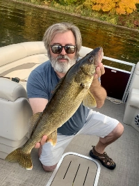 Walleye are the central species in most Lake Kabetogama fishing conversations, and for good reason. Productive walleye water often includes reefs, points, shoreline breaks, narrows, gravel, sand, bays, and deeper transition structure. Early in the season, walleyes often hold shallow during and after spawn. As summer progresses, guides repeatedly describe fish sliding deeper toward reefs, 15- to 30-foot structure, and more defined breaklines.
Common walleye tactics on Lake Kabetogama include jigs tipped with minnows, live bait rigs with leeches, evening slip bobbers, and trolling passes when fish are active. Low-light windows remain especially important, and local guide conversations repeatedly reinforce the value of adapting depth before abandoning an area entirely.
Smallmouth Bass
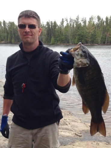 Smallmouth bass give Lake Kabetogama another strong dimension, especially for anglers who enjoy casting and moving between rocky structure and shoreline edges. Bass often overlap with some of the same broader zones used by walleye anglers, which makes them a natural bonus species during multi-
species trips.
Smallmouth bass give Lake Kabetogama another strong dimension, especially for anglers who enjoy casting and moving between rocky structure and shoreline edges. Bass often overlap with some of the same broader zones used by walleye anglers, which makes them a natural bonus species during multi-
species trips.
Rock, reefs, shoreline structure, and island edges all matter. Depending on season, smallmouth can reward both targeted bass tactics and opportunistic presentations made while fishing broader mixed-species water. Competitive bass results also reinforce the lake’s quality: at the 2025
Minnesota B.A.S.S. Nation Team Trail event hosted at The Pines of Kabetogama, 46 teams weighed 195 fish, released 99 percent of them, and the biggest fish reached 5.65 pounds.
Northern Pike
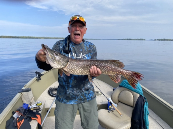 Northern pike are a steady part of the Lake Kabetogama fishing experience and often show up around weedlines, bays, shallower cover, and transition areas. Pike are especially useful when anglers want to fish faster or stay active while walleye patterns are changing.
Spinnerbaits, minnows, and presentations along active weed edges can all produce. Pike are also a reliable species for anglers exploring a mix of shallow cover and adjacent transition water.
Jumbo Perch
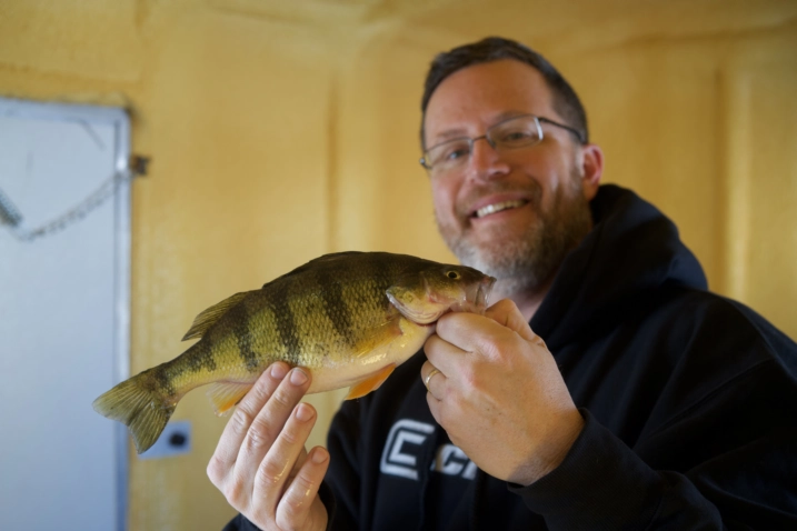 Perch are an important but sometimes overlooked part of Lake Kabetogama fishing. They often show up in many of the same broader seasonal conversations as walleye, especially during low-light periods and around productive structure transitions.
Smaller live bait rigs, jigs, and careful depth control can all help anglers connect with perch, especially when fish are grouped around productive contours rather than spread broadly across the lake.
Crappie
Crappie are a meaningful part of the multi-species story on Lake Kabetogama, particularly for anglers willing to fish bays, weeds, cover, and suspended schools when the timing is right. While not as dominant a theme as walleye, they remain a recurring species in local conversations and can provide excellent action in the proper seasonal windows.
Slip bobbers, smaller jigs, and strong depth control are often key. Crappie patterns can be especially rewarding when anglers want a change of pace from reef and breakline fishing.
Lake Kabetogama Fishing Tactics by Season
Spring
Spring fishing on Lake Kabetogama often begins with very cold water, shallow fish, and post-ice-out caution. In some years, water temperatures can remain in the low forties around opener, which means spawning and post-spawn fish may still be concentrated in shallow water. Jigs, minnows, and slower presentations are recurring early-season themes, especially around bays, shorelines, gravel, sand, and emerging weeds.
Spring is also the time to handle big female fish carefully and release them quickly. That ethic came up repeatedly in the Lake Kabetogama Fishing and Recreation Report archive and is part of the local fishing culture on Kabetogama.
Summer
As summer settles in, many fish move away from the shallow post-spawn pattern and relate more strongly to reefs, weedlines, breaks, channels, narrows, and deeper transition water. Guides repeatedly describe summer fish setting up in the 15- to 30-foot range while still leaving some activity in shallower or evening-accessible areas.
Leeches, live bait rigs, evening slip bobbers, and more deliberate structure fishing become especially important. Summer is also when anglers need to trust electronics, control depth carefully, and avoid assuming the fish are still where they were a few weeks earlier.
Fall
Fall Lake Kabetogama fishing is defined by transition. Guides repeatedly describe fish shifting between shallow and deep water, with some patterns developing on weedlines, bays, and shallower cover while other fish continue to hold on reefs, basin edges, and deeper structure. That means fall often rewards anglers who remain flexible and test more than one zone before settling into a pattern.
It is also a time when weather changes, cooling trends, and bait location can quickly reshape the day. If there is one recurring fall message from the transcripts, it is that anglers need to keep adjusting instead of assuming the lake is fishing one way everywhere.
Low-Light and Evening Windows
Some of the most dependable Lake Kabetogama fishing happens during low-light periods, especially in the evening. Multiple guides mention evening slip-bobber patterns, shallow feeding windows, and fish pushing up during calmer late-day conditions. On some spring patterns, dock fishing and shallow shoreline bites can become especially strong when wind and light conditions line up.
If the daytime bite is inconsistent, an evening adjustment is often one of the highest-value changes an angler can make on Lake Kabetogama.
How Wind and Conditions Affect Lake Kabetogama Fishing
Local guide conversations make one thing very clear: Lake Kabetogama fishing changes with conditions. Wind direction, recent storms, cooling trends, lightning, and changing water temperature all influence where fish set up and how confidently they feed. Some winds can push fish shallow and improve dock or shoreline opportunities, while rough conditions may also make parts of the lake difficult or unsafe for smaller boats.
Instead of treating weather as background noise, successful anglers on Kabetogama use it as part of the pattern. That means checking current conditions, adjusting depth, and being willing to move from reefs to weedlines, from bays to narrows, or from daytime structure to evening windows as the lake changes.
Plan Your Lake Kabetogama Fishing Trip
A successful fishing trip is not only about where to fish. It is also about having the right access, equipment, and place to stay. The Pines of Kabetogama gives anglers a practical base for Lake Kabetogama fishing with lodging, marina access, and boat rental options that make it easier to spend more time on the water.
If you are planning a trip, pair this evergreen guide with our Kabetogama Fishing Report for timely conditions and weekly observations from local guides. You can also explore boat rentals and lodging options to build a trip around the season, target species, and fishing style that best fits your goals.